Beaches

Blowhole Beach
Blowhole Beach lies at the western boundary of Deep Creek Conservation Park. Access is via a steep four wheel drive descent to a car park on the eastern headland, otherwise there is car parking at Cobblers Hill two kilometres inland.
The beach lies at the base of a steep valley with a creek draining across the eastern half of the beach, and with headlands and rocks extending 100 metres seaward. The sandy beach is 120 metres long, with a 70 metre wide bar that usually has a permanent rip against the western rocks which can be hazardous, particularly if there is also surf.
Care should be taken in both accessing the remote area and when in the water. An entry fee to Deep Creek Conservation Park is required.
Boat Harbor Beach
Boat Harbor Beach is located in the Deep Creek Conservation Park. The road to the beach is accessed by 4WD only. Park entry fees apply. Due to its remoteness, prevalence of rocks, reefs and permanent rips, this beach is hazardous. The beach can only be accessed by walking down a steep cliff.

Carrickalinga beach lies immediately north of the low Haycock Point and runs north for 1.4 kilometres to 50 metre high Carrickalinga Head. A 50 metre wide foreshore reserve, road and three rows of houses back the beach. The road terminates at a car park and a reserve is on the slopes of the head. Carrickalinga creek drains across the southern end of the beach. Between Haycock Point and the car park is a relatively safe sandy beach, while on the point and north of the car park rock reefs front the beach.
Carrickalinga is a swimming beach and is relatively safe under normal conditions.
 Fishery Beach
Popular fishing beach. This beach was home to a whaling station in the 1840's/1850's and some ruins remain. In 1862 it became a shipping port for the export of ore from the nearby Talisker Mine. On clear days Kangaroo Island can be seen. This is also the point where the submarine cable leaves the mainland and feeds power along the seabed to the Dudley Peninsula on Kangaroo Island.
Lady Bay Beach
Lady Bay Beach is found in-between Normanville Beach and Marina St Vincent.
The beach offers a rocky reef perfect for crabbing. It is also the location of the HMAS Hobart lookout offering amazing views of the beach and surroundings.
Further south of the lookout, the beach becomes sandy, making it perfect for swimming and collecting a variety of shells.
Lady Bay Beach is a beautiful and unique beach setting against the backdrop of dramatic hills.
 Morgan's Beach
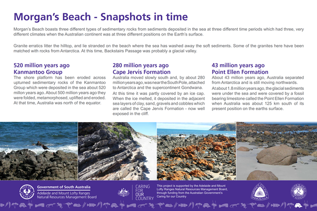
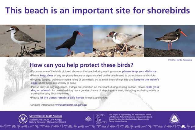
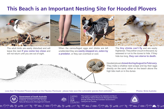
Morgan's Beach is a sandy beach, nestled below 50 metre high cliffs. There is a gravel road from Cape Jervis to the bluff that overlooks the beach and Starfish Hill Wind Farm to the north. Explore the rocky reef at the southern end of the beach and enjoy a swim in the clear waters up the beach. Morgan's Beach is easily accessible to the public.
Morgan's Beach Signs (2406 kb) (Click to download a PDF of the below signs)


 Myponga Beach
Myponga Beach occupies a small valley that has been carved by Myponga Creek and is now partially filled with river and marine sediments forming a flat plain occupied by a few houses. An elongate lagoon and wetland flows across the southern end of the beach. Houses and shacks line the rear of the beach; so much so a seawall has been built to protect some of the properties.
Fifty-metre high grassy bluffs border each end of the beach, with rocks and reefs extending seaward. It is moderately steep and fronted by a narrow continuous bar, with waves averaging about 0.5 m. The beach was used as a port and the ruins of the old jetty are still present. Swimming is relatively safe in the sandy central portion of the beach and it is a popular spot for both launching boats and for shore-based fishing off the adjacent rock reefs. Launching boats can be hazardous here, please check beach and marine conditions before attemping to launch boats.

Normanville is the largest coastal settlement on the Western Fleurieu Peninsula. The town is located in the centre of the 7.3 kilometre long beach, with Lady Bay and 100 metre high Yankalilla Hill forming the southern boundary and low Haycock Point the northern.
Normanville and Carrickalinga beaches are relatively safe under normal conditions. Best access and facilities are located at Normanville and Carrickalinga. The best shore fishing is from the Normanville Jetty and Haycock Point. Most fishers head out into the gulf in small boats, which can be launched from the beach at Normanville but please check beach and marine condition before attempting to launch.
Normanville Beach is a patrolled by the Normanville Surf Life Saving Club during the summer.

- sand dunes store and stabilise the sand which nourishes the beach and prevents erosion?
- dunes provide a back-up supply of sand for storm situations
- dunes provide a unique habitat for native flora and fauna
- dunes are nature's defence of the land behind, providing shelter from salt spray and wind
- sand boarding on the dunes is prohibited
- removing fauna and flora from the dunes is prohibited
- fires cannot be lit in the dunes at any time
- materials or non-indigenous flora and fauna cannot be dumped in the dunes (including lawn clippings)
- horseriding is only allowable in designated areas
- camping is not allowable at any public area except for designated camping sites

Nestled between long sandy beaches and towering cliffs, Rapid Bay is 105 kilometres south of Adelaide and reached by a steeply descending road from the main Normanville-Cape Jervis Road.
Rapid Bay is well known for its very long jetty. While the original jetty built in 1940 is closed to the public, a new jetty (opened in early 2009) is now available for use. Take a stroll along the jetty and enjoy fishing and the beautiful views.
At Rapid Bay, you'll also find an important South Australian landmark - a boulder on which Colonel Light carved his initials after he first stepped ashore. It's reported that he said "I have hardly seen a place I like better".
Rapid Bay was named after the brig HMS Rapid in which Colonel Light and his staff came to South Australia, discovering Rapid Bay in 1830 enroute to Glenelg.
Rapid Bay is usually calm and relatively safe. It's a paradise for divers and snorkelers, with dramatic shipwrecks and stunning marine life, including the famed Leafy Sea dragon.

Second Valley Beach is an unpatrolled beach, divided by a jetty into two smaller beaches.
Follow the open valley that narrows at the coast to a gap, through which flows the small Parananacooka Creek and the road to the beach. The small town and caravan park lies on the landward side of the gap. Once through the gap there is a small car park leading to a jetty with the two small beaches to either side.
To the west is a north facing curving long boulder beach attached by rock reefs to a small headland. Conditions are usually calm at this part of the beach; however it is dominated by rocks and reef.
The main beach is popular in summer and usually calm. It offers stunning views of the coastline and unique geological formations. This beach is popular for swimming, jetty fishing, snorkelling and scuba diving.

Tunkalilla Beach is a straight beach, backed by a low foredune and wave overwash deposits, and continuous grassy slopes. The surf zone averages 60 m in width and is cut by beach rips every 250 m in the west, with several reef controlled rips to the east. This is the only publicly accessible beach, with a car park located on the bluffs above the western end of the beach. It is a hazardous beach due to its moderate to occasionally high waves, strong permanent rips and prevalence of rocks and reef. It is popular with fishers who do not mind the steep walk back to the car park. Overall, it is a scenic but largely inaccessible section of coast, offering several pocket beaches each bounded and backed by steep grassy slope.
For dog restrictions on beaches visit Council's Website.
Diving and Snorkeling

Whether you are a novice or an experienced diver, you will be impressed by the diversity of diving opportunities in Yankaillla Bay. A variety of shore, jetty and boat dives attract divers from all over the world. Snorkelling is popular at Second Valley, Rapid Bay and Carrickalinga.
For the qualified diver, why not dive the ex HMAS Hobart, scuttled in Yankalilla Bay on 5 November 2002 to form an artificial reef, or search for the elusive Leafy Sea Dragon off Rapid Bay.
Blowhole Beach
This beach is located within Deep Creek Conservation Park and can only be accessed by 4 Wheel Drive. It is therefore very much an unspoilt dive site.
Divers must be of a high skill level. Crayfish, seals and Leafy and Weedy Sea Dragons can be viewed here.
Carrickalinga Beach and Myponga Beach
Many wonderful shore reefs are found within metres of the beach and provide great snorkelling fun for all the family.

Ex HMAS Hobart Dive Wreck
On 5 November 2002 the ex HMAS Hobart was scuttled in Yankalilla Bay to form an artificial dive reef. The Hobart's final resting place lies 4 nautical miles west north west of Marina St Vincent. Of the 3 naval vessels that have been scuttled in Australia,the Hobart is currently the most intact with 90,000 square metres of the ship open to diver access including access to the engine room, missile launcher, gun turrets and both funnels.
The Hobart was nicknamed the 'Green Ghost' for her reputation has quiet vessel during 3 tours of duty of Vietnam. The Hobart was the most decorated naval vessel of her era and we are proud that her final resting place is in Yankalilla Bay. As a premier dive attraction, her memory and that of the people who serve on her will live on. A land based memorial has been established at Lady Bay where the anchor from the ship lies pointing in the direction of the wreck.
It's Australia's most accessible and exciting wreck, scuttled off Wirrina Cove. For information on what is required to dive the ex HMAS Hobart Click here.

Rapid Bay
Often described as the best jetty dive in Australia, the 470m long Rapid Bay jetty will not disappoint.
Divers can expect to see a large range of fish and marine life including the Leafy Sea Dragon.
Rapid Bay Head is home to a number of reefs, caves, interesting marine life and sea grasses. Rapid Bay Head can be reached by boat from Rapid Bay, Marina St. Vincent or from Cape Jervis.
Second Valley
Second Valley is a popular dive training site. Small caves are located in the area and make for an interesting dive. Lasseter's Reef is a dome shaped reef 50m in diameter and 300m from the beach.
It is a great spot for marine life including the rare Leafy Sea Dragon
Licensed Operators
NB Scuba - (08) 8323 8275 / 0406 202 738 www.nbscuba.com.au *This operators tours are bookable through our Visitor Centre*
Underwater Sports Diving - (08) 8263 3337 www.underwatersports.com.au
The Dive Shack - (08) 8371 5822 www.thediveshack.com.au
Scuba Divers Federation of SA - http://www.sdfsa.net/
Fishing

There are many great fishing locations in the Yankalilla district area. Why no launch your boat or fish for snapper, quid, shark and tommies form rocks or the jetty. A number of fishing charters operate from Cape jervis.
Lookout for whiting holes around weeds or if fishing around reefs and rocks try for mulloway, salmon, flathead, shark, bream and rockfish between Carrickaling and Normanville.
Second Valley and Rapid bay are great for fishing off the jetty and rocks for garfish, flathead and squid. Keep an eye out for kingfish, trevally, salmon, squid, tommies and Yellowtail kingfish at the Rapid Bay jetty or offshore from a boat.
Great rock fishing can be found at Wirrina Cove, along with a boat ramp for offshore catches of salmon, rock fish, flathead, shark and whiting.
Click here for a guide to the local fishing spots
